Real World Terrain Data
Longest Front » Devlog

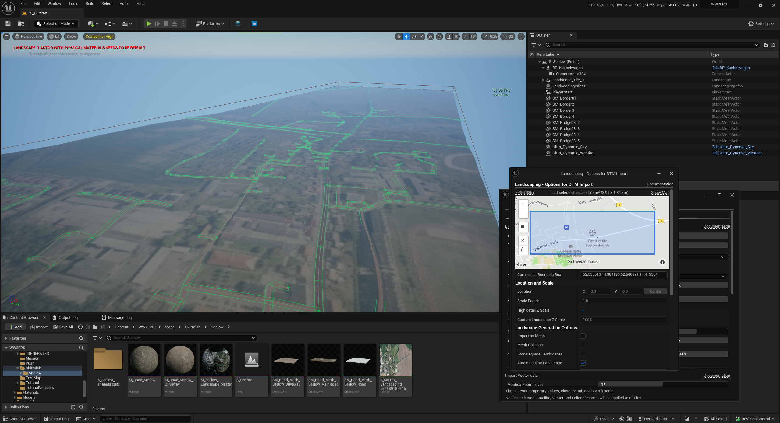
Starting a new map is never easy. One approach I'm trying at the moment is importing real world height data, satellite images and street splines as a starting point. For this I'm using the awesome Landscaping plugin for Unreal Engine. This approach allows using the actual locations where battles took place. In the image you can see a part of Seelow where the largest battle on German soil took place in World War 2.
This approach saves time, but there is still a lot of work involved in making a map:
- Cleaning up the splines and assigning road meshes
- Painting the terrain (the satellite image is very low resolution and can only be used as reference)
- Adding grass, trees and rocks
- Adding buildings and props
- Setting up control points and spawning
Next I'm going to explore how to maybe automate some of the using procedural tools.
Get Longest Front
Longest Front
Realistic WW2 shooter with bots.
| Status | In development |
| Author | DesertFox |
| Genre | Shooter |
| Tags | Co-op, First-Person, FPS, pve, Singleplayer, Unreal Engine, World War II, ww2 |
| Languages | English |
More posts
- Flexible Loadouts!7 days ago
- Create your own maps and mods!13 days ago
- WW2FPS is now Longest Front15 days ago
- Engine Update & Spawning in Vehicles19 days ago
- Battle of the Seelow Heights!34 days ago
- Fire Teams55 days ago
- More map flexibility86 days ago
- New skirmish settingsAug 28, 2024
- New gun shot audio!Aug 25, 2024
- Maps are back and other improvements!Aug 21, 2024

Leave a comment
Log in with itch.io to leave a comment.